
Category: Greening Sanjeevi Hills
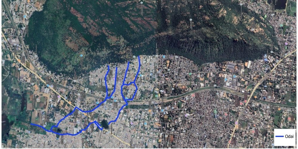
This map highlights an important stormwater flow route in Rajapalayam, beginning in the Sanjeevi Hills and travelling over 2 kilometres before reaching its final collection point at Alathankulam. Like other traditional ‘odai’ systems in the town, this channel plays a crucial role in guiding seasonal rainwater safely through urban neighbourhoods.
The flow originates from the headwaters of Sanjeevi Hill and first moves through Malaiyadipatti, then along T.P. Mills Road. It continues into Sanjeevinathapuram, where the local ‘oorani’ (water tank) is also replenished by this odai. From there, the channel passes through the Cotton Market area and Avarampatti before reaching Alathankulam, which serves as the final stretch and primary collection zone.
Structurally, this corridor consists of a 2.1 km main odai supported by two sub-odais that merge into the primary channel at different points. As these tributaries join, the water volume gradually increases toward Alathankulam.
Together, this interconnected drainage network forms an essential natural infrastructure system. Preserving and maintaining these stormwater corridors is vital for sustainable urban water management, groundwater recharge, and flood mitigation in the city.