
Category: Carbon Neutrality
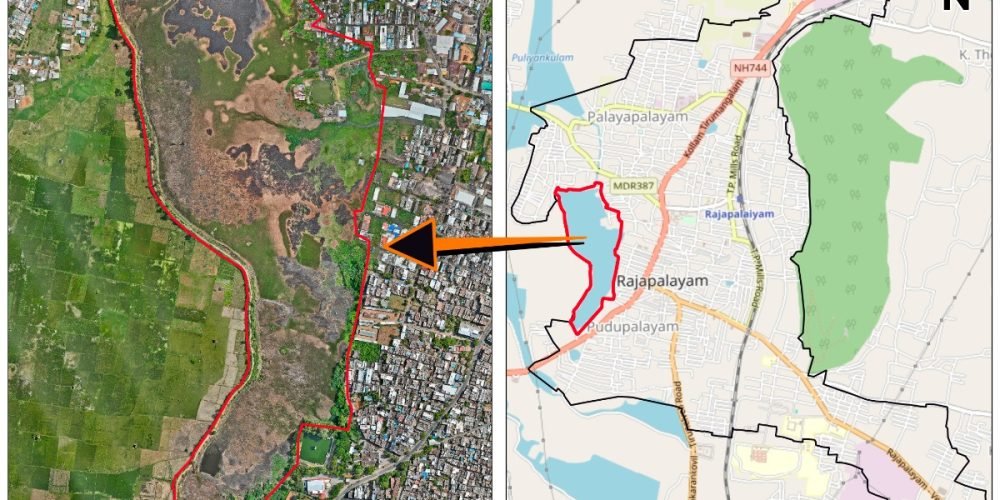
Kondaneri Kanmai is a large water body located within the city limits. It has quietly shaped the life and landscape of the town for generations. Covering 44.46 hectares and with a storage capacity of nearly 0.5 million cubic metres, the kanmai has long supported irrigation, recharged groundwater, and moderated floods.
Rainfall from Sanjeevi Hill naturally drains into the tank through a network of traditional odais, now augmented by urban stormwater channels. This flow links the hill, the town, and the tank into a single hydrological continuum.
The name Kondaneri itself reveals its origins. It refers to an ēri, or man-made irrigation tank, historically associated with the Kondan ayacut-holding community. In a time when water governance was rooted in collective responsibility, cultivators jointly maintained the tank, managed inflows, regulated irrigation, and protected the agricultural lands it sustained.
Even today, Kondaneri Kanmai plays a crucial role in protecting Rajapalayam from flooding while replenishing wells and sustaining surrounding farmlands. Its continued relevance underscores an enduring truth: when water systems are designed in harmony with terrain and community, they remain resilient across centuries.